Carmen's World
Friday, May 15, 2015
La Loire à vélo : Day 5 : Clisson to Nantes
Thursday, May 14, 2015
La Loire à vélo: Day 4: Yseron to Clisson
Wednesday, May 13, 2015
La Loire à vélo : Day 3: Ancenis to Yseron
Tuesday, May 12, 2015
La Loire à vélo : Day 2 : Saint Germain des Prés to Ancenis
Monday, May 11, 2015
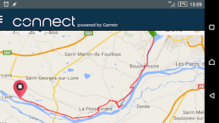
La Loire à vélo : Day 1: Angers to Saint Germain des Prés
Saturday, June 7, 2014
Brittany Rain Tour 2014 - Recap
Last week, I cycled about 340 km in Brittany France, starting from Brest in the west, and ending in the border between Brittany and Lower Normandy, visiting the Mont Saint-Michel. I anticipated and prepared for a week full of rain, hence the tour name "Brittany Rain Tour 2014", but throughout the week, I only received a few drops. I guess the Celtic sun god Belenos was with me.
As with previous tours, it was enjoyable to be out in the countryside and forget my e-mails for a week!
Maps
This is the path I took, as recorded by my GPS: |
| Brittany Rain Tour 2014 - Entire trip |
You can see an interactive map of the entire trip here.
These are the daily steps of the tour. Click on each map to see the the track in an interactive map with stats:
|
|
|
|
|
|
|
|
Blog posts
If you missed the daily commentaries and photos, you can catch up by following these links:- Day -6: http://c6rm3n.blogspot.fr/2014/05/brittany-rain-tour-2014-day-6.html
- Day -5: http://c6rm3n.blogspot.fr/2014/05/brittany-rain-tour-2014-day-5.html
- Day 1: http://c6rm3n.blogspot.fr/2014/05/brittany-rain-tour-2014-day-1.html
- Day 2: http://c6rm3n.blogspot.fr/2014/05/brittany-rain-tour-2014-day-2.html
- Day 3: http://c6rm3n.blogspot.fr/2014/05/brittany-rain-tour-2014-day-3.html
- Day 4: http://c6rm3n.blogspot.fr/2014/05/brittany-rain-tour-2014-day-4.html
- Day 5: http://c6rm3n.blogspot.fr/2014/05/brittany-rain-tour-2014-jour-5.html
- Day 6: http://c6rm3n.blogspot.fr/2014/05/brittany-rain-tour-2014-jour-6.html
- Day 7: http://c6rm3n.blogspot.fr/2014/05/brittany-rain-tour-2014-day-7.html
- Day 8: http://c6rm3n.blogspot.fr/2014/05/brittany-rain-tour-2014-day-8.html
- Day 9: http://c6rm3n.blogspot.fr/2014/06/brittany-rain-tour-2014-day-9.html
Stats
None of my blogs would be complete without a table or charts.The following table shows the distance traveled each day, the time I was outside each day, the average speed (includes breaks) and average moving speed (only includes when I was cycling or walking).
| Day | Tour step | Distance (km) | Time | Average speed (km/h) | Average moving speed (km/h) |
|---|---|---|---|---|---|
| Day 1 | Brest – Landerneau | 26.49 | 03:01:20 | 8.8 | 11.7 |
| Day 2 | Landerneau – Morlaix | 44.10 | 05:50:36 | 7.5 | 12 |
| Day 3 | Morlaix – Lannion | 42.34 | 04:39:46 | 9.1 | 13 |
| Day 4 | Lannion – Guingamp | 44.82 | 04:48:58 | 9.3 | 14.4 |
| Day 5 | Guingamp – Saint-Brieuc | 45.69 | 04:53:38 | 9.3 | 14.3 |
| Day 6 | Saint-Brieuc – Pléven | 39.12 | 03:13:31 | 12.1 | 16.3 |
| Day 7 | Pléven – Saint-Malo | 49.84 | 04:25:17 | 11.3 | 14.8 |
| Day 8 | Saint-Malo – Pontorson | 50.06 | 05:56:20 | 8.4 | 14.6 |
| Total | 342.46 | ||||
| Average | 42.81 | 04:36:11 | 9.3 | 13.9 |
Since I traveled more lightly on this tour than previous tours, perhaps because I had a real bike pump to inflate my tires to maximum recommended pressure, and probably because I paced myself better this time, compared to other tours, my average moving speed was about 14 km/h.
My previous tours, in comparison:
- 2013: Crossing France: 1186 km, 9.3 km/h average, 12.9 km/h moving average
- 2012: Paris to London: 301 km, 8.8 km/h average, 11.0 km/h moving average
- 2011: Paris to Bordeaux: 665 km, 8.5 km/h average, 10.3 km/h moving average
As for this trip, I took it easy this time, only cycling about 45 km per day, compared to 60 or 65 on previous trips.
Fun stats
- This tour was:
- about the distance walked by backpackers to create this HD time-lapse video of Yosemite National Park.
- a bit longer than the distance of the "Total 200", a route covered by crazy cyclists in one day (miles version), which will take place next weekend.
- just longer than the distance of the "Tahoe 200", a running race around lake Tahoe this fall which must be completed in 100 hours (just over 4 days).
- about the distance from Long Beach to San Diego and back.
- the distance Indian man Mani Manithan walked backwards, naked, to promote peace.
- the distance blind Australian Liam Haven walked from Sydney to Canberra, for which he was awarded the Guide Dogs Victoria's Freedom Award.
- The tour was about 24 hours and 43 minutes of cycling time. Depending on the source, this corresponds to between 5100 - 8000 calories burned during cycling. This equals:
- 10 to 15.7 French Big Macs (or 9.2 to 14.5 American Big Macs).
- 108 to 170 McNuggets
- 453 to 711 Life Saver candies
- almost my body weight in celery
Cows
When I was on the road, I couldn't include videos in this blog. Now that I'm at home, with a real computer, I can finally edit this blog normally. Here's a video of some cows eating (very exciting!):And the sun and clouds each day of the trip:
Conclusion
That's it! Thanks to the people who followed along and commented. Where will the next tour be.....?Sunday, June 1, 2014
Brittany Rain Tour 2014 - Day 9
This morning, during breakfast at the hotel, I took a picture of my orange juice. Why? Well, I've noticed that in all the hotels where I've had breakfast, it's always a self serve buffet, and the plates and glasses are abnormally small, in some cases ridiculously small. I'm sure it's a psychological trick to make you take less food. It doesn't work on me though. If I know I'm going to be cycling for 4 or 6 hours, I eat accordingly. :-) But today,the glass for the orange juice was almost as small as a shot glass,so I had to take a picture. I think I got up to refill it five times.
Today I visited the Mont Saint Michel. I was able to bike up to a parking lot which is about a 40 minute walk to the island, and leave my bags in a locker while I visited the site.
My first impression was that there wasn't much there besides restaurants and cheap souvenir shops. I had lunch in one of the restaurants there: I ordered moules frites. Afterwards, I bought a galette Bretonne from one of the shops: a huge cookie. I also bought a pin of the Breton flag, which I've put on my backpack to remind me of this trip.
On the road today, I saw:
* sheep
* horses
* tour bikes parked with all their gear left on the bike (I think we're still not in Paris anymore, Toto)
* A family cycling on the same path as I.
* A group of bike tourists at the train station
* cow sculptures which were not scary at all
* road signs warning about cyclists
* absolutely no grocery store open when I had two hours to wait for the train and wanted to buy a snack to munch on.
So, while today has been a sad end to my trip, the rest of the trip was a perfect cycling trip: beautiful scenery, great cycling weather, conversations with cows, a visit with co-workers, not too difficult routes and distances. On my paper map (which is now "done"), I see there are some long distance cycling routes running North /South. Maybe I'll come back to Brittany for another "Rain Tour" some day!


