Sunday, December 1, 2013

Learning French Geography

I love geography quizzes, and maps.  I'm pretty sure geography wasn't among my favorite subjects in school, but for some reason, I can spend hours just navigating around in Google Earth or playing quizzes online, trying to beat my personal best time trying to locate the 50 states of the US, the countries of the world, state capitals, etc.   I guess I'm low maintenance and easy to entertain.

GeoFun

A few years ago, I developed a geography game for Android devices, GeoFun, in which the user must find as many cities as possible within 90 seconds.  The goal is to tap as closely as possible to the given city, striving for both accuracy and speed.  At the time, I don't think there were other geography games on Android which worked this way, although today there are probably several.   In this type of game, it is often difficult to get 100% accuracy as a city only occupies one pixel on the screen.   If your finger doesn't cover this pixel, then the distance for this guess is non-zero.


After comments from users that it was too "difficult" to guess cities, I made the game a bit easier, even though 100% accuracy was never the goal: wherever you tap on the screen, I add a buffer circle of about 1cm diameter (the size of your fat finger touching the screen).  If the city happens to be anywhere inside this circle, the distance is zero.   After this modification, some users still seemed disappointed when they did not guess 100% accurately.  Not finding any new ways to try to make the game easier for users while keeping the basic principle of the game the same (if the game asks you to select Paris and you tap near Madrid, what can I do anyway?), I developed a new tongue-in-cheek "game" called You're a Winner! which tells the user how awesome they are every time they press a big red button.  If you tap on Madrid when trying to locate Paris, and you still want a high score, You're a Winner! is probably a better game for you.  So now I recommend You're a Winner! to GeoFun users who say that this geography game is "too hard".

But I digress...

French departments quiz

Other geography games allow 100% accuracy (and therefore happier users as their egos are more easily placated) by focusing on locating regions (states or countries) instead of cities, or guessing the capitals of states or countries.  One of these games is for the French departments, made by Nicolas Cornette.

(For strangers to French geography: France is divided into several regions, each region divided into several departments, and each department has a prefecture, or capital.)

This app allows you to quiz yourself on on the 101 departments in France:
  • Finding the department on a map
  • Guessing the region in which a department is located
  • Guessing the capital of a department
  • Guessing the number (postal code) of the department
I figured I should learn the French departments since:
  • Quizzing myself on the US states was getting old
  • I've been living in France for a while
  • My knowledge of the French departments is crap
  • This cool app was developed by my very own coworker, so I can make feature requests to him directly!
I thought I'd do an experiment and record my score for each test, as well as how long it took to complete the test, and see what my learning curve looks like.   Oh yeah, I also really like charts and graphs.  Again, I'm a low maintenance person.

Find the deparment

I started out with the "find the department on the map" quiz.  In this quiz, you are given the name of a department, and you have to tap on its location on the map.  You have three attempts for each department.  You basically get 3 points for getting it right on the first guess, 2 points for getting on the second guess, and 1 point for getting on the third guess.   The total number of possible points is 303 for the 101 departments.  The score you see at the end is the percent of your points divided by 303.

The first attempt I recorded had a shameful score of 42%, and it took me almost a half hour to complete the quiz.   17 more tests and three hours later, I finally reached a score of 100%!  And the last test took less than 7 minutes.


The score line is almost a straight line if we plot it on a logarithmic scale:

The first few tests take the longest, but they are the tests where the most is learned.  It took me about two hours of quizzing before I was able to improve a whole 50% (from 42% to 92%).  That's two hours of studying to improve from an F to an A, on the American grading system.  Then one more hour to perfect this to 100%.  I think the lesson we can take away from this is that perhaps when I was in school, I still could have gotten A's with 33% less studying.   That's 33% more time I could have had for biking, playing music, and wishing the internet existed already so I could be playing geography quizzes and blogging with charts of my progress.

I also like animated gifs.  So, here's one showing the progress of the "find the department" quiz:
Find the department quiz

This is a sequence of the "Game Over" screen at the end of each of the tests.  The departments in green are the ones I guessed on the first attempt.  The red ones are the ones I failed to guess after three attempts.  And the in-between colors are for departments I guessed correctly after one to three attempts.   My apologies to the daltonians out there.  Maybe you don't even see an animated gif :)

Name the capital

The next quiz I attacked was the "name the capital quiz".  In this quiz, you are given the name of a department, and you have to provide the name of its capital.  You can either type the capital name or choose it from the list of 101 capitals.   Again, you have three attempts for each department.

The result of the first test was interesting:
First test result of the French capitals quiz

Why this green band running from the north to the south, surrounded by red almost everywhere else, except the southeast?  The green zones are the areas I passed through on my cycling trips across France.  I've also visited some cities in the south of France.  Most of the major cities I've visited happen to the be the capitals of their departments.

Instead of doing an intensive cramming session over a few hours, I played this game once or twice per day over a week.   For some reason, there were a few departments that I consistently failed to guess nearly every time.  I eventually took some time to review these capitals on the map (the app provides a search function which is handy for this) before continuing testing using the quiz.  So the learning curve for the capitals is not completely based on the capitals quiz alone.


This curve is not logarithmic at all. Why? Maybe because I didn't cram, or maybe because I took some time to review the map between quizzes.

And the animation sequence of each Game Over screen:

I plan to learn the numbers of the departments next.  I have a feeling this will be more difficult than learning the location of the departments or their capitals.  Too bad this proposal from the French revolution wasn't accepted:
Proposal for French departments after the revolution

Conclusions    


  • It's still possible to learn after being out of school for nearly 10 years.
  • The French Department quiz is a great tool to learn the departments.
  • I have no life.


Saturday, August 3, 2013

Bike trip along the Seine river in Fontainebleau forest

This weekend, we followed a suggestion on the Transilien website for a bike trip: in the Fontainebleau forest.  We took the train from Paris to the south-east limit of the forest (Moret Veneux-les-Sablons) and biked along the Seine river up to the northern limit of the forest (Melun). In total we may have done about 43 km today, but the main ride was about 25km.

BoD recently acquired a phone mount for the handlebars of his bike, and used an Android app called CycleDroid to track our movement.   The data recorded by his phone with this app was almost identical to the data recorded by my Garmin GPS.  This is the path we took:


As we went through Blois-le-Roi, we discovered the Base des Loisirs, which had a beach filled with sunbathers and people enjoying a dip in the water.

Here are a few of the photos we took today.  You can see all the photos from today's trip in the gallery.

At the beach in Blois-le-Roi
Map check 
BoD cloned himself for extra horsepower 
Panorama of the Seine river near La Rochette 
Wheat fields 
Swans

Sunday, July 21, 2013

Bike ride to Parc de la Villette and priority to the right

Biking to La Villette

This Saturday, we biked over to Parc de la Villette.  It seemed like the rest of Paris was also outside, taking advantage of the sun.  After taking a nap on the grass, we continued biking along the Canal de l'Ourcq for a bit, before turning back.   We stopped for dinner at Belushi's, where it seemed that the waiters preferred to speak English rather than French.  Not that I minded :)  The total trip was around 25 km.

The route to the park:


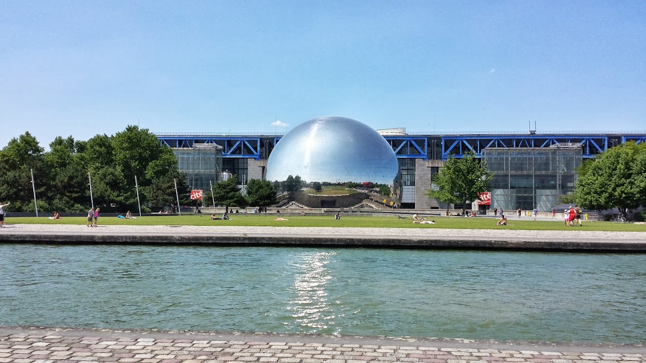
La Géode
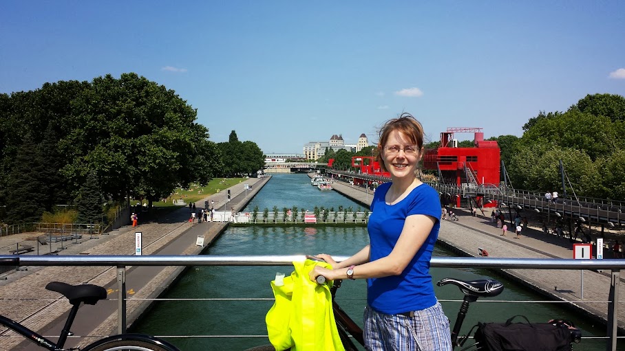
The canal
Me in front of the canal
You can never have too many pictures of huge shiny bawlz
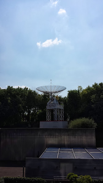
The SETI at work
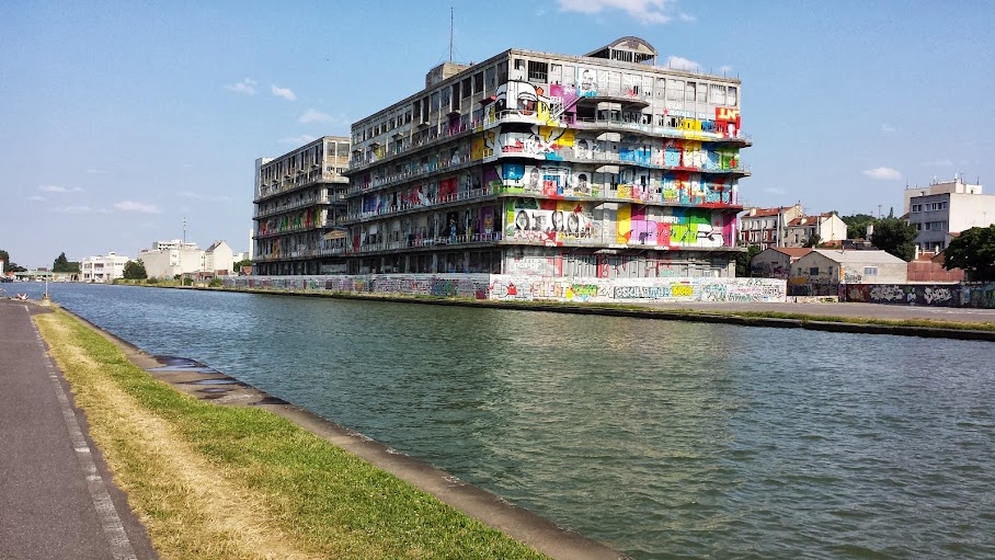
"Art"


Priority to the right

The other day, as I was biking home from work, I was heading east on a rather large street (an avenue with traffic in both directions), and a motorcycle delivering sushi was waiting on a small one-way perpendicular side-street.  He was facing north, and wanted to turn right (east) onto the avenue.  He entered the avenue just as I approached the intersection.  


Seeing as he cut me off, I rang my bike bell (which is quite loud :)) several times.  Much to my surprise, he actually stopped to talk to me.  He told me that he had the right of way.  I couldn't believe that a vehicle entering a large avenue from a small one-way side street could possibly have priority over the traffic on the avenue, and I insisted upon this point.  The driver of the motorcycle simply just kept repeating one phrase: "priority to the right".  He also offered, in a rather condescending way, to buy me a book of traffic code in France...  My big mistake in this whole ordeal is forgetting that the traffic code in France (or anywhere, I suppose) is not always logical or even safe.  Indeed, since there was no other signage or markings on the ground at this intersection, the priority by default is given to the right, regardless of the size or "importance" of the two streets.  Sigh.  I hope I never see Mr. Sushi again, because I'm quite embarrassed now.  Fortunately, that is not the road I usually take to go home.  I did find some consolation by discovering that other people on forums complain about the priority-to-the-right not making sense or even being safe in some cases.

Saturday, July 13, 2013

Biking from Paris to Versailles and preparing the way for stage 21

Taking advantage of the unusually long streak of sunny days in Paris, we went on another bike trip today, this time from Paris to Versailles.  At Versailles, we met with a friend, Guillaume, who will be climbing the Alpe d'Huez next week, which is stage 18 in the Tour de France 2013.  This ascent has an average grade of 8% over 13 km.  My GoPro camera is very excited to be joining him on his journey.

As we biked to Versailles, we noticed that we were on part of the path of stage 21 of the Tour de France 2013 (the last day of the race).  About 3 km of this path on Pavé des Gardes was pretty tough for us, at about 4.3% average grade, if the elevation measurements from my Garmin are to be trusted.   Guillaume told us he hopes to be able to do the Alpe d'Huez in a bit over one hour.  Seeing how hard doing just 4% over 3 km was for us today, I think I'd consider it a personal accomplishment to just be able to finish the Alpe d'Huez without having to get off and walk my bike :)

On the way home, we saw a group of American (I assume, from the accent) bike tourists, with loads of gear on their bikes.  I wanted to ask them where they were from and where they were touring, but I didn't seize the moment :)

This is the route we took today.  You can see the details of this route and the return route, uploaded from my GPS.
Path from Paris to Versailles

Signs along the road warning about the roads being blocked off for the Tour de France

The start of the main hill on Pavé des Gardes in Chaville, on the return trip.

At Versailles.

Elevation profile for the trip to Versailles. The selected data point is the highest point on the trip.

Tuesday, July 9, 2013

Bike trip to Bois de Boulogne and other tourist traps

This weekend we took a bike trip to Bois de Boulogne, and also stopped by the Eiffel Tower, Champ de Mars, Invalides, dinner at HD Diner Opéra, and finally returned home.  The trip was a total of 32km.


Here's a video from our outing: I mounted the camera to the handlebars of my bike and set it to take one picture every two seconds.  It ran out of battery just as we arrived at the Eiffel Tower.


And some photos:
What can you say
The tourist
Taking a break in Bois de Boulogne
Samsung S4 "Beauty face" mode smooths my skin :) Now if i could only make it work in real life...

Panorama of a small lake in Bois de Boulogne

Saturday, June 8, 2013

Biking south east of Paris


Last week we took a 33km bike ride along the Seine south of Paris, and this week we had a shorter 15km stroll through Bois de Vincennes.

Today it was about 27°C/81°F.  Feels like summer already.  This is welcome after an extended winter this year.  In a couple of weeks, it will be officially summer!

The path we took to Choisy-le-Roi/Orly
Viewing the bridge over the Seine river, near Maisons-Alfort
The path we took to Bois de Vincennes
At the Vincennes castle

When we were on avenue Daumesnil, I recognized the road from a video we had taken back in 2006.  We redid the same video today, and the two videos, 7 years apart, can be seen side-by-side:

The photo galleries from last weekend and this weekend are here:
Last weekend: to Choisy-le-roi
This weekend: Bois de Vincennes.

Saturday, May 25, 2013

B&You : HSPA+ #fail @Paris 13

English speakers, you may read the automatic translation of this post: http://translate.google.com/translate?sl=auto&tl=en&js=n&prev=_t&hl=en&ie=UTF-8&eotf=1&u=http%3A%2F%2Fc6rm3n.blogspot.fr%2F2013%2F05%2Fb-pas-de-hspa-dans-le-13eme.html&act=url

Depuis plusieurs semaines, BoD et moi constatons des problèmes de réseau avec nos téléphones mobiles.  Nous sommes tous les deux chez B&You depuis environ un an.

Le problème qu'on constate est que chez nous, la data fonctionne pendant une ou deux minutes.  Ensuite, il est impossible d'utiliser internet.  Si on essaie de se connecter à Google dans le navigateur, on ne voit rien pendant environ 10 secondes, puis on voit une erreur "serveur introuvable".  Si on met le téléphone en mode avion, puis on désactive le mode avion, internet fonctionne bien de nouveau, mais encore seulement quelques minutes.  Puis les problèmes de connectivité et les erreurs de "serveur introuvable" reviennent.

BoD a contacté l'assistance B&You, qui lui a envoyé une nouvelle carte sim.  Pas de surprise, la nouvelle carte sim avait exactement le même comportement.  (Je ne raconterai même pas les soucis pour activer la carte sim, commençant par le site web de B&You qui ne fonctionnait pas.  Seule une menace de quitter B&You et aller chez Sosh a abouti à l'activation de la carte).

Nous avons remarqué qu'en désactivant la data 3G, et en n'autorisant que la data en 2G (EDGE, GSM), nous n'avions plus aucun souci pour nous connecter à internet.  Sauf, bien entendu, que la connexion en 2G est plus lente qu'une connexion (qui fonctionne correctement) en 3G.

L'application Network Monitor

Curieux de comprendre mieux les conditions dans lesquelles notre connexion fonctionne ou pas, nous avons développé une application Network Monitor, qui est open source (pas encore disponible sur le Google Play Store).  Cette application fait un test de connexion périodiquement, qui consiste en une requête GET simple sur le serveur web principal de Google.   Après chaque test de connexion sur le site de Google, l'application stocke le résultat du test (PASS ou FAIL) dans une base de données sur le téléphone, ainsi que d'autres informations concernant le téléphone et la connexion, comme par exemple :

  • Le type de réseau (WiFi, mobile/EDGE, mobile/HSPA, etc)
  • Le SSID WiFi ou APN
  • La localisation du device (latitude, longitude)
  • Les identifiants de l'antenne relais
  • Le nombre de barres de la connexion (de 0 à 4)
  • D'autres informations fournies par le framework Android (surtout la classe TelephonyManager).
L'application permet d'exporter un rapport sous Excel (et d'autres formats) contenant toutes les données enregistrées, et une synthèse listant le taux de succès des tests par antenne relais.


Les résultats des tests et les données récupérées par Network Monitor, sur une tablette
L'exportation du rapport

Les resultats des tests

Avec Network Monitor, nous avons fait des tests croisés, avec des cartes sim Orange, SFR, et B&You, dans des devices différents :
  • HTC One S
  • Galaxy S4
  • HTC Desire
  • Asus Transformer EEE Pad
  • Sony Xperia Go

En voici un résumé des résultats :

B&You SFR Orange
HTC One S &
Galaxy S4
3G activé (HSPA+) 13ème arrondissement KO Pas testé OK
3G désactivé (EDGE) 13ème arrondissement OK Pas testé OK
3G activé (HSPA+) En dehors du 13ème OK Pas testé OK
HTC Desire 3G activé (HSDPA) Partout OK Pas testé OK
Sony Xperia Go 3G activé (HSPA) Partout OK Pas testé OK
Asus Transformer EEEPad 3G activé (HSPA) 13ème arrondissement OK OK Pas testé

Le problème décrit n'arrive donc que dans les conditions suivantes (cumulatives) :
  • Dans le 13ème arrondissement de Paris,
  • Et avec les cartes sim de B&You,
  • Et dans le HTC One S et le Galaxy S4 (les seuls devices à se connecter en HSPA+),
  • Et avec la data en 3G autorisée

Les antennes relais qui déconnent

Le rapport envoyé par l'application sur mon HTC One S montre qu'il y a quelques antennes relais où les tests de connectivité réussissent moins de 25% du temps.   Malheureusement, c'est uniquement ces deux antennes relais (220772, 204043) qui sont utilisés chez nous.
B&You :
LAC=20031,CID=24164(220772): 16% (6 tests)

LAC=20031,CID=7435(204043): 21% (85 tests)


LAC=20031,CID=17954(214562): 55% (18 tests)

LAC=20031,CID=804(197412): 66% (6 tests)

LAC=20251,CID=37394(14782994): 95% (22 tests)

LAC=20251,CID=37395(14782995): 95% (86 tests)

LAC=20251,CID=1282(14746882): 96% (122 tests)

LAC=20251,CID=1281(14746881): 97% (192 tests)

LAC=194,CID=3611(3611): 100% (1 tests)

LAC=20251,CID=587(27853387): 100% (1 tests)

LAC=318,CID=30746(30746): 100% (3 tests)

LAC=20251,CID=1976(14747576): 100% (3 tests)

LAC=20251,CID=1977(14747577): 100% (4 tests)

LAC=20251,CID=30387(14775987): 100% (9 tests)

Orange :
LAC=1021,CID=22767(1136879): 100% (1 tests)

LAC=1021,CID=36354(1150466): 100% (1 tests)

LAC=1021,CID=47617(1161729): 100% (1 tests)

LAC=14341,CID=22119(611943): 100% (1 tests)

LAC=1021,CID=35048(1149160): 100% (2 tests)

LAC=14341,CID=50952(640776): 100% (2 tests)

LAC=832,CID=46292(46292): 100% (3 tests)

LAC=14341,CID=12500(602324): 100% (3 tests)

LAC=14341,CID=63618(653442): 100% (3 tests)

LAC=1021,CID=27020(1141132): 100% (4 tests)

LAC=1021,CID=1914(1116026): 100% (5 tests)

LAC=14341,CID=5139(594963): 100% (5 tests)

LAC=14341,CID=5463(595287): 100% (5 tests)

LAC=14341,CID=20851(610675): 100% (6 tests)

LAC=1021,CID=5731(1119843): 100% (7 tests)

LAC=1021,CID=63369(1177481): 100% (8 tests)

LAC=14341,CID=43441(633265): 100% (8 tests)

LAC=1021,CID=56288(1170400): 100% (11 tests)

LAC=1021,CID=49821(1163933): 100% (12 tests)

LAC=1021,CID=15442(1129554): 100% (19 tests)

LAC=14341,CID=63485(653309): 100% (27 tests)

LAC=1021,CID=42922(1157034): 100% (110 tests)

LAC=1021,CID=22510(1136622): 100% (186 tests)

Quoi faire ?


Il suffit d'enlever n'importe laquelle de ces conditions pour avoir un internet qui fonctionne correctement :
  • Changer de téléphone.  Je pourrais utiliser le Sony Xperia Go ou un autre téléphone moins récent que mon HTC One S, qui ne supporterait pas la norme HSPA+.  Mais le HTC One S est mon meilleur téléphone, donc j'ai envie de l'utiliser :)
  • Ne pas utiliser 3G.  C'est ce que je fais en ce moment.  À la maison, j'utilise WiFi, et en dehors (dans mon quartier), je suis obligée de passer en 2G/EDGE pour acceder à internet.
  • Déménager.  Oui, je pourrais déménager pour avoir tout le temps internet sur mon téléphone.  J'énumère toutes les options, histoire d'être exhaustive.
  • Essayer de résoudre le problème avec l'assistance B&You.  Jusqu'ici, cette voie n'a pas l'air le plus prometteur.   
  • Changer d'opérateur.  On verra.  Vous lisez ceci, B&You ?

Des précisions

EDIT : Network Monitor est maintenant disponible sur le PlayStore.

EDIT : Il est à noter que malgré le fait qu'internet ne fonctionne plus du tout en HSPA+ après quelques minutes, nous avons toujours une bonne reception : l'icône dans la barre de notification montre toujours 4 ou 5 barres sur 5.  Je dois préciser également (comme on l'a fait pour l'assistance B&You), qu'il ne s'agit pas d'une lenteur.  En HSPA+, internet fonctionne correctement pendant quelques minutes, puis plus du tout.

Ça remarche !

Mise à jour du 14 juin 2013 : Depuis quelques jours on n'a plus aucun souci pour se connecter en HSPA+, sur le HTC One S et Galaxy S4, chez nous !  Les antennes relais sont toujours les mêmes, mais elles fonctionnent maintenant.   Par contre, je n'ai aucune nouvelle de B&You.  Depuis que Sébastien de B&You a commenté sur mon blog, il m'a demandé où précisément j'avais des problèmes de connectivité, je lui ai répondu, et je n'ai eu aucune réponse depuis.

BoD a eu plusieurs échanges par e-mail avec l'assistance B&You.  Frustré par leur incompréhension du sujet (ils lisaient clairement pas ses explications du problème), il est parti chez Sosh.

On ne saura peut-être jamais pourquoi les antennes relais se sont remises à fonctionner.  Une machine a été redémarrée lors d'une maintenance prévue ? L'assistance a finalement compris les e-mails de BoD, mais n'a pas pu répondre car il était déjà parti ?  Tout cela restera un mystère qui, avec un peu de chance, ne se repetera pas.

Sunday, May 12, 2013

Triceracycling east of Paris

My photographer didn't accompany me on yesterday's bike ride, so I couldn't easily be in the pictures.   I thought that taking pictures of solely roads and trees would be dull, so I invited my triceratops to come along with me and pose in the pictures.

Yesterday's bike ride was 87 km and followed two paths I had previously done partially, years ago, but on separate occasions:
  • The Canal de l'Ourcq
  • The Marne river
This is the path I took:

Roughly speaking, in this map, the Canal de l'Ourcq portion of the trip is the upper part of the loop, and the Marne river is the lower part.  Most of the trip was on paths alongside the canal and river, which made for pleasant riding.  I was quite motivated once I got out of Paris after about an hour of cycling, finally leaving behind the traffic and stoplights.  I went pretty fast (for me) along the Canal de l'Ourcq, maintaining a speed between 20-25 km/h.

But after getting slightly lost and finding myself riding on grassy fields on private property, I decided to cut over to the Marne river a few km earlier than planned, and head home.  As I headed back home on the second half of the loop, along the Marne river, I was starting to feel tired.  My speed probably dropped to around 10-15 km/h for that part of the trip.  Apparently my average moving speed for the whole trip was around 14 km/h.  This is a bit better than my average speed on my trip across France.   I guess it's not too surprising considering I had less gear on this time!  I had fewer clothes packed, no spare inner tube or bike pump, and of course nothing like soap, toothbrush, etc.  However, I did have twice as much water (1L) and a whole triceratops...

The whole trip was about 8 hours long, with about 2 hours for breaks.

My ride took me within about 5km from Disneyland.  I didn't bother stopping to visit.  My triceratops would kick Mickey's butt any day.

Here are a few photos from the trip.  More photos are in the gallery.

At the beginning of the Canal de l'Ourcq, still in Paris
Enjoying a nice view of the Ourcq canal
Ah, the fresh smell of springtime
Having a strawberry yogurt snack.  This triceratops is vegetarian, but not vegan.
Next to the bike path which follows tramway T3 in the south of Paris
Exhausted after a long day
These and more photos are in the gallery.

The time/date and location captions on top of each picture were added by the app BoD made just for me: PicLabel.  He's just published it on the Play Store so other people using Android can also have fun with this simple but useful app :)

Wednesday, May 8, 2013

Bike trip near Versailles

This weekend, we went on a bike trip from Paris to Trappes, in the Yvelines department about 30 km southwest of Paris.  The path took us through Meudon forest, Versailles, and the Saint Quentin pond.  I had done part of this trip several years ago, in 2006.  This was before I had the luxury of a GPS, and I'm pretty sure I got lost a few times back then.

Just before arriving in Trappes, we missed a "no bikes" sign (it actually had been removed, although the "no mopeds" sign was still there) and found ourselves on the N10: the Route Nationale 10.  This road is almost like a freeway.  In fact, the freeway A12 ends and merges into the N10 right where we entered the N10.  This was a bit scary, but we found an exit soon enough: a hole in the fence which separates the Saint Quentin pond park from this road.

Below is the 33km path we took on Saturday.  The roads varied from bike lanes in Paris, to small streets in the suburbs, to unpaved roads surrounded by trees in Meudon forest, to almost-freeway craziness, to scenic paths in the Saint Quentin pond park.

A bit tired on Sunday, we only did 23km: We biked from Trappes to Versailles, then took a break and visited the park and lake at Versailles.  We lucked out with beautiful weather.  It is starting to feel like summer already.  After relaxing in the grass for an hour or so, we took the RER train to Pont de Garigliano (southwest limit of Paris), and then biked to Avenue de France, where we rewarded ourselves with a nice Tex-Mex dinner.  Appropriate for a Cinco de Mayo, even though we happen to be in the losing country as far as that holiday goes.

Paris to Trappes by bicycle

We placed my camera on the handlebars of one bike, and set it to take a photo every five seconds throughout the trip.  The result is a few humorous shots as well as some time-lapse (and possibly headache-causing) videos.

Time-lapse videos


Time-lapse video of the trip out to Trappes on Saturday:
(The most interesting, or at least entertaining, part of this video just might be our lunch break.)


Time-lapse video of the return trip:

Photos

Here are a few photos from the trip.  More can be found in the gallery.
Checking my GPS in Meudon forest
BoD's view for several hours
Respect cyclists! And that means you.
Yay! Destination reached!
Whew! Made it!
More photos from this trip are in the gallery.